My Favorite Hikes near(ish) to Provo, UT
A huge benefit of living in Utah is access to incredible hikes and scenery all over the state. It’s something I loved continuing to discover when visiting and eventually living there.
I’ve compiled my favorite hikes near(ish) to Provo – some are a bit farther out. I’ve done all of them with an exception of Squaw Peak (I’ve driven to the overlook), and Mount Timpanogos (Matt completed it before we moved!).
You can view the hikes through the map below, by distance below that, and by alphabetical order before that.
Hikes
Click on the icons on the map for more information.
Listed by distance in miles (click the link for more info below)
Devil’s Kitchen 0.2
Bridal Veil Falls 0.5
Cascade Springs 0.5
Grotto Falls 0.6
Ensign Peak 0.8
Red Potato Trail 1.7
top of The Y 2.2
Alien Tower 2.5
Timpanogos Cave 3
Donut Falls 3.1
Stewart Falls 3.4
Fifth Water Hot Springs 4.5
Horsetail Falls 4.6
Tibble Fork 4.6
Big Springs Hollow 5
Rock Canyon 5.5
Yellow Fork Canyon up to 6.8
Sqaw Peak 7.3
Dry Creek up to 10.5
Mount Timp 15
Provo River Trail up to 15.2
Bonneville Shoreline Trail up to 100
Below are the same hikes from above but with description – they are listed in alphabetical order. You can click on the image for more information.

Alien Tower
I wish I knew about this hike sooner! Based in Draper, this 2.5 mile hike does have some steep parts near the end, but gives an incredible 360 degree overlook – you can see both the Salt Lake Valley and the Great Salt Lake, as well as a view far down into Utah County, overlooking Utah Lake. The alien tower hike is amazing for both sunsets and sunrises, too.
Big Springs Hollow
Located in Provo Canyon, Big Springs Hollow is a 5 mile out and back trail - pretty casual, but a nice area to be outside. It’s usually very quiet. When I went, the "big spring" was a bit watered down because of a recent storm, so check conditions before you go.

Bonneville Shoreline Trail
This trail can be as long and tough or as short and sweet as you want. It's currently over 100 miles! But I've taken it as a nice sunset hike with beautiful views of Provo. Great for riding bikes, too.

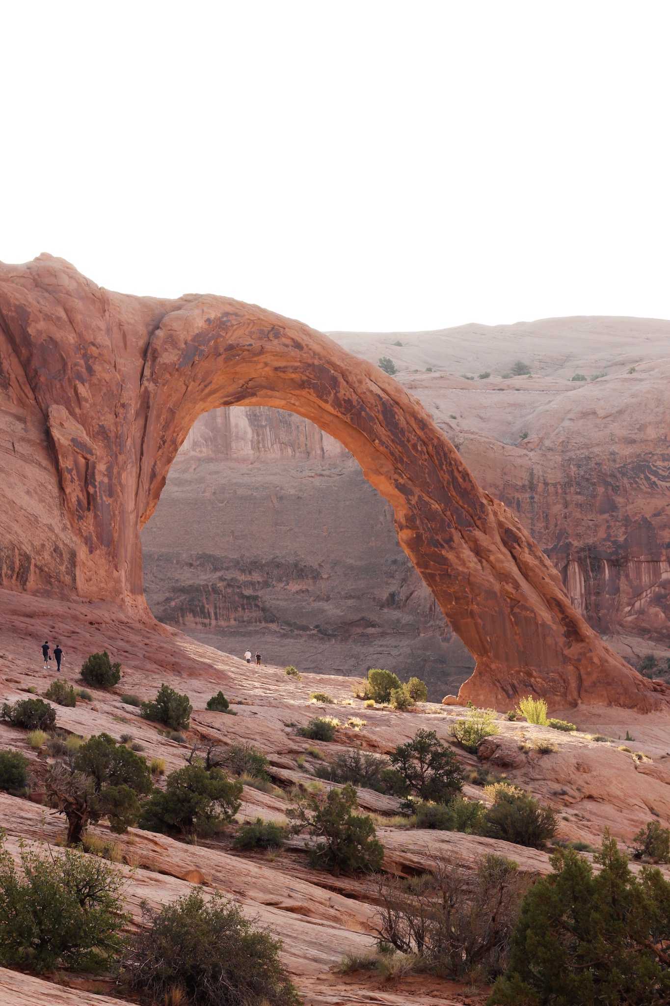
Bridalveil Fall
Super easy 0.5 round trip trail - completely flat leading to a magnificent 620 foot waterfall. You can also see it from the highway as you pass. For those with disabilities or who aren’t very steady, access via the Provo River Trail means that the trail is paved the whole way, so it’s very safe.

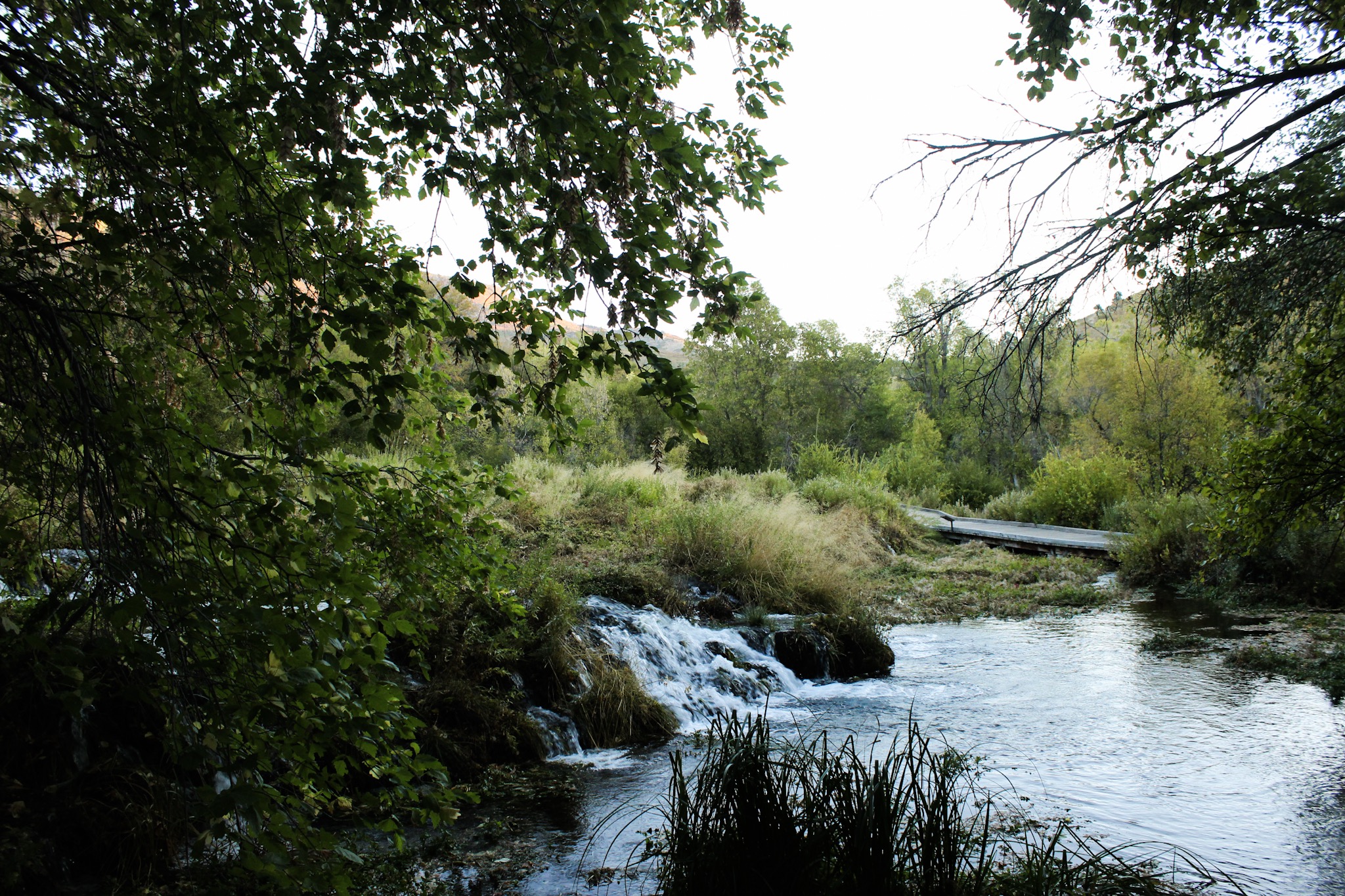
Cascade Springs
We camped out the night before and watched an incredible sunrise on the way here. It's a quick 0.5 mile walk around the springs, easy and accessible trail. Beautiful scenery.

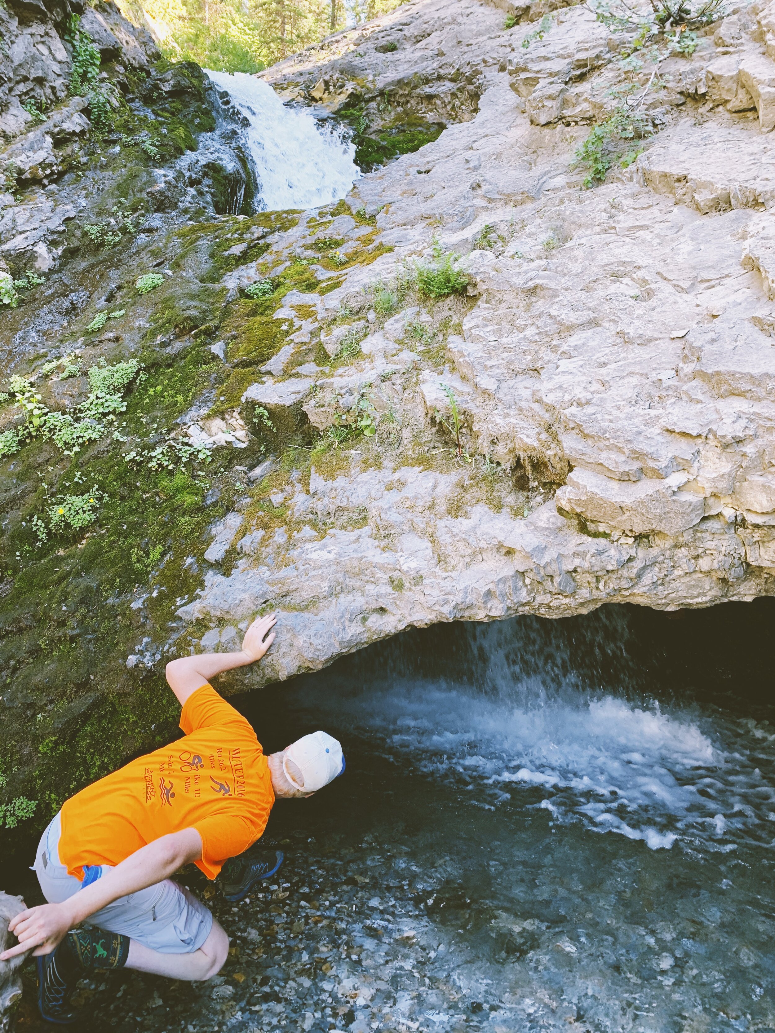
Devils Kitchen
The trail to Devil's Kitchen is only 0.2 miles and the real adventure is in the drive. Especially in the fall, with the changing leaves, it's incredibly beautiful.
Donut Falls
This 3 mile round-trip hike goes by fast and is really easy. If you want to climb up to see the falls for it's namesake, then it's a little tough (and make sure you wear water shoes!) but refreshing in the summer and worth it. Note: dogs are not allowed on this trail.

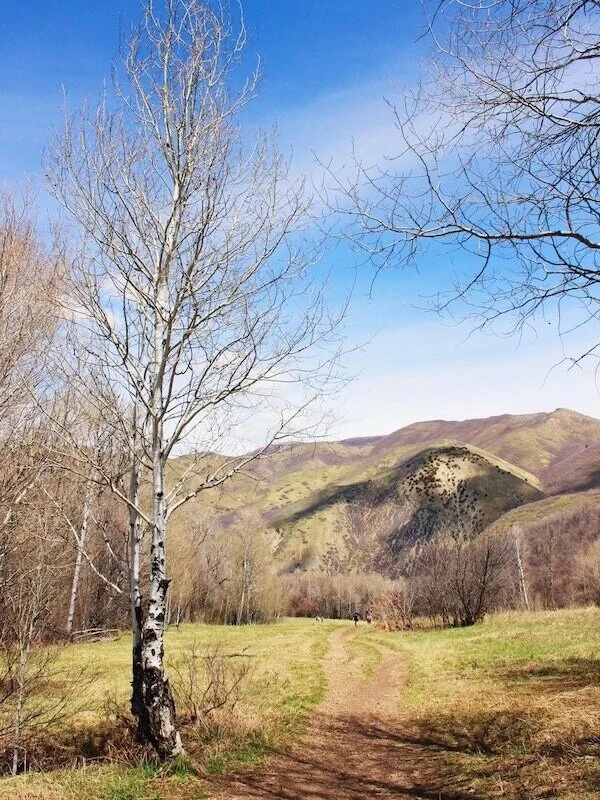
Dry Creek
Dry Creek is an up to 10.5 mile trail, but to get the view, you only need to go up maybe a mile. It can get a little steep, but is pretty shaded.

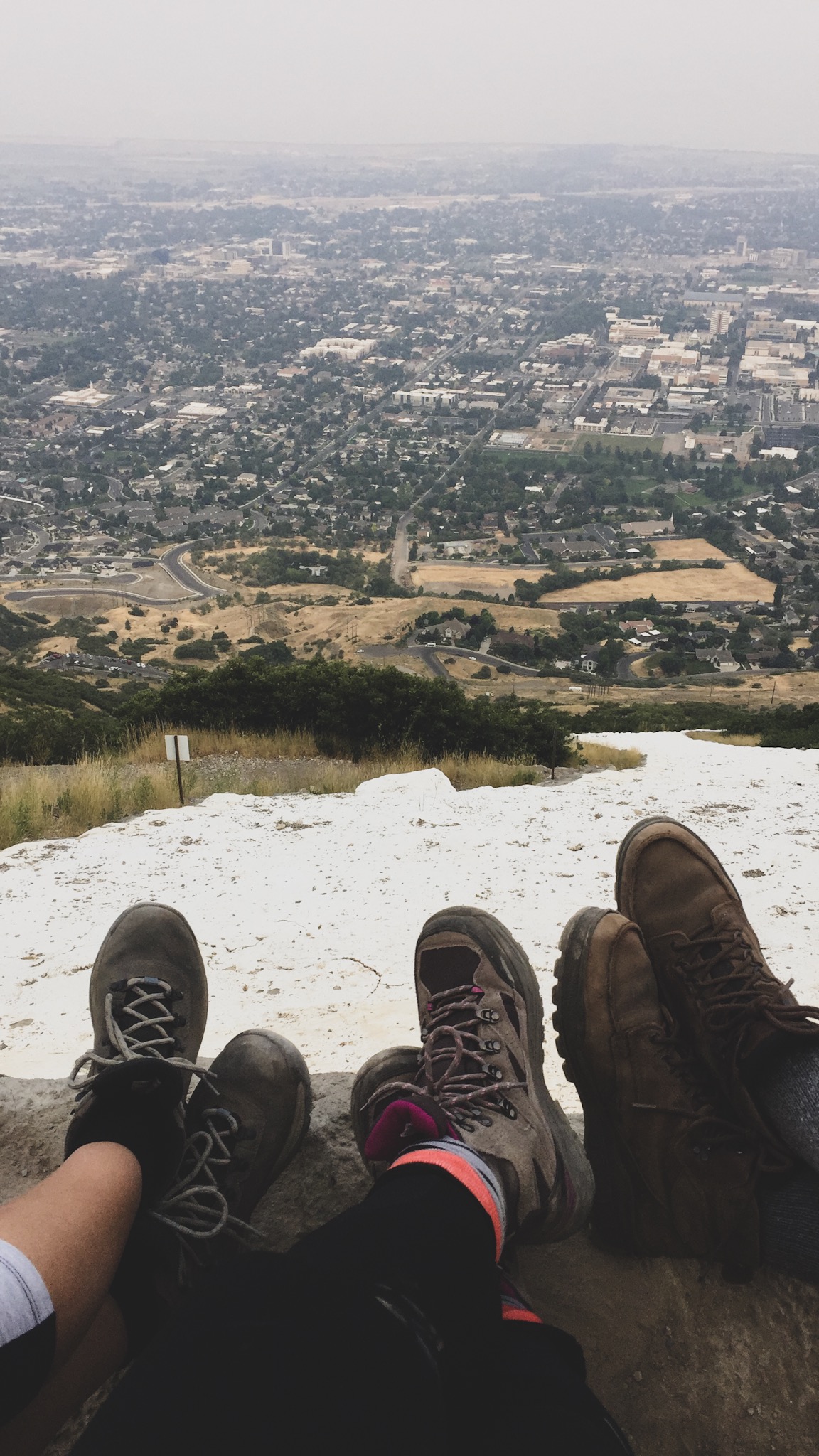
Ensign Peak
Ensign Peak is an easy/moderate .8 mile hike up to a beautiful overlook. Nice in spring/summer/fall - a little icy and slick in the winter but still doable.

Fifth Water Hot Springs
4.5 miles roundtrip with a nice relaxing ending at the hot springs. They really are pretty hot, so cooler temperatures are a great time to appreciate them the most! Also beautiful in the winter time.

Grotto Falls
Grotto Falls is an easy 0.6 mile hike out and back. It can be harder if the water is higher, so just make sure to check conditions beforehand.

Horsetail Falls
A 4.6 mile trail, a little steep at times and somewhat difficult, but fun! Make sure to look for the rope that leads down to the falls.
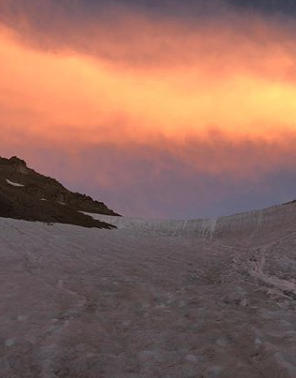
Mount Timpanogos
This is a 15 mile out and back trail – and it is hard, but it is also doable. Matt did it in July 2020, and there was still some snow at the summit – definitely bring some warmer clothes. Many people hike up at night, camp and watch the sunrise the next morning.

Red Potato
Nice overlook and view at the top of the hill (although can be a bit windy and quick but steepish climb). The Red Potato Trail is 1.7 miles out and back and connects to the Bonneville Shoreline Trail.

Rock Canyon
This 5.5 mile trail is gorgeous! I can also understand why there's so many people who rock climb here. Definitely a hike worth doing.
*photo is from https://www.rockcanyonutah.com/

Provo River Trail
Up to 15.2 miles wandering through various parts of the Provo River. The trail is mostly flat, and is great for walking, jogging, bikes etc. I personally think it's best by tandem ;)

Saratoga Hot Springs
This isn't so much of a hike, but it's worth mentioning. It's a nice park area with a path along the water and it leads to some relaxing hot springs.

Squaw Peak Overlook
You can hike 7.3 miles to the overlook through Rock Canyon, or you can drive up to it (during the snow months, the entrance will be blocked off to cars). This is one of my favorite overlooks in Utah.

Spiral Jetty
Some say this can be a "hike" because there's a little hill you can climb up for a better overlook, but it's really just a really cool art work and also scenery with the salt lake and the many interesting colors. A little bit of a bumpy and somewhat long drive out (especially from Provo), but well worth it! Might as well stop by the Golden Spike along the way.

Stewart Falls
I've been on this 3.4 mile hike in summer, winter, spring (and I wish fall!) – it's one of those hikes that's long and hard enough to feel like you've hiked but not too much where you're completely spent the rest of the day.

Tibble Fork
This 4.6 mile trail goes around the Tibble Fork Reservoir through some nice shady areas. Be aware there's no cell phone service and you'll need to pay for parking, so bring some cash or check. It's a truly beautiful area.

Timpanogos Cave
An amazing site to hike to if you’re in Utah any time between May and the beginning of September. After a 1.5 mile hike that climbs steeply 1,092 feet and gets you to 6,730 feet above sea level, you reach the cave entrance. The views of the canyon alone make the hike worthwhile, and you can also just take the hike without going into the cave. Make sure to make a reservation for the tour in advance.

Top of the Y
Most people hike to the top of the Y, which is 2.2 miles round trip, but you could also go past and do a 6.6 mile trail. This is very steep, and is listed as hard, but it's doable – little kids can definitely do it. There's switch backs and markers to show you how far you have come (or have to go).

Yellow Fork Canyon
Up to 6.8 miles of easy paths. You can make it short and do a loop around. There’s picnic tables available making a nice place for lunch.